Nanjō City, Okinawa Prefecture
Looking Down on Nirai-Kanai Bridge An afternoon looking down at the road I’d just driven, with the sea beside it
The bridge is 660m long and 80m high, on the descent from the Tsukishiro side along Prefectural Route 86 toward National Route 331. On a May afternoon, I took my time looking at the road's shape and the Pacific from the walkway above it. I'd love to pair this view with a drive down from the mountains toward the sea.
Read about the moment I spent looking down at the bridge and the sea on a May afternoon.
SummerA May afternoon
Shading My Eyes, I Traced the Curve of the Bridge
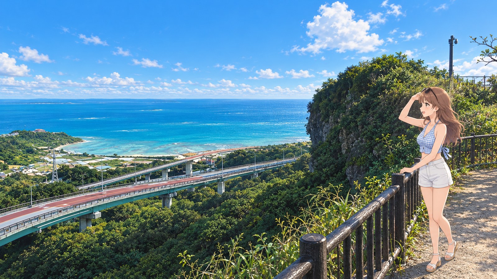
On a May afternoon, I stopped on the walkway overlooking Nirai-Kanai Bridge. The road curled in from the lower left, then wound behind the trees. Beyond them was the sea. I'd driven across it just moments ago, but I still found myself saying, “So this is what it looks like?”
I left my sunglasses perched on my head and shaded my eyes with a hand. I followed the bridge's red roadway until it disappeared beside a tree-covered rock face. I couldn't see the whole thing, so I traced the rest from memory. Bit by bit, the bend below me began to line up with where I'd turned the steering wheel.
When I was driving down the bridge, what stayed with me most was the moment the sea came into view after the tunnel. Now that I'd finished driving and was standing here on foot, it was the road itself that caught my eye. I could make out even the slender streetlights and the bridge girders, and get a sense of its scale against the sea. I'm glad I got to drive it and take in the view from here.
I rested one hand on the railing, and the breeze lifted the ends of my hair. Sunlight warmed the shoulder showing above my light blue top. I looked out to sea, then back toward the shallows by the shore, where the light shifted with the contours of the seabed. I'd come to study the shape of the bridge, but somehow I spent longer looking at the sea.
They say Nirai-Kanai means a paradise beyond the sea. When I first heard the names of the two bridges, I just thought Nirai and Kanai sounded cute together. Now, whenever I look out to sea, that name comes to mind. Instead of searching for anything, I just let my eyes rest all the way to the horizon. My shoulders loosened, too.
I was about to head back along the walkway when I turned around one more time. For a photo, I wanted to fit in plenty of sea and still keep that red line of the bridge. I turned this way and that until I had the road winding down toward the water in frame. Next time, I want to bring my driving friend to see it. It'd be fun to trace the route together, talking about where the sea first came into view.
The story sections are fiction inspired by this location. For accurate information, please consult official tourism and information websites.
Local specialty
Okinawa soba
The driving route toward Chinen in Nanjō City includes stops for Okinawa soba, too. After taking in the bridge and sea, I'd love to stop for a warm bowl of soba.
Highlights
The Curve Where Two Bridges Meet
Nirai Bridge and Kanai Bridge join to form a road that curves down from the mountains toward the sea. From the lookout above, you can take your time tracing the shape of the road you just drove.
The Sea Beyond the Name
Nirai-Kanai means a paradise beyond the sea. I thought of that name as I looked along the Pacific horizon beyond the bridge. My shoulders finally relaxed.
Road Details
Nirai-Kanai Bridge (Prefectural Route 86)
- Bridge Length
- 660m
- Bridge Height
- 80m
From the Tsukishiro side, the bridge curves broadly toward the sea as it descends to National Route 331.
The 660m length and 80m height are figures from Nanjō City's official tourism guide. You can enjoy the curve from two perspectives: as you descend from the mountains and from the walkway above.
More Spot Guides
If you enjoyed this story, you might like these places too. I've gone back to each of them in different seasons, again and again.