Ibigawa, Gifu Prefecture, on the border between Gifu and Fukui Prefectures
Kanmuriyama Pass An autumn pass where you’ll want to take in every mountain ridge
I pulled my coat collar close and looked up. There, beyond the leaves, was a rocky peak. The whole drive through the mountains suddenly felt special.
Read about the view that greeted me when I stepped out of the car at this pass wrapped in autumn leaves.
AutumnMid-October to early November
An Autumn Morning Looking Up at a Rocky Summit, Coat Collar Pulled Close
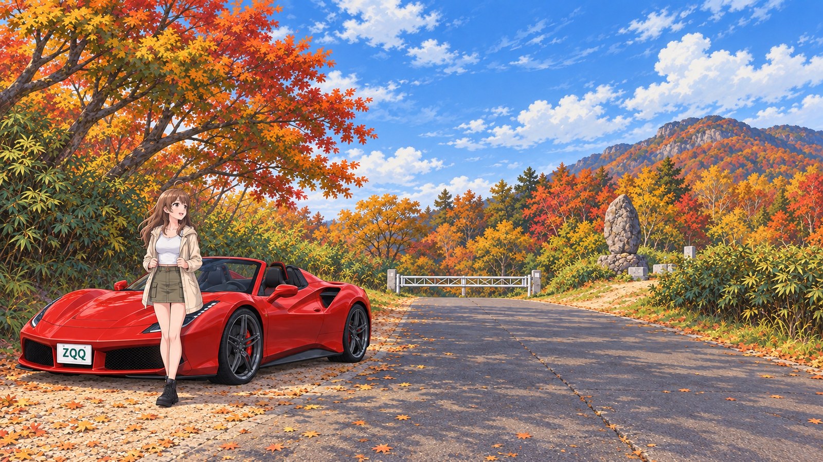
The main reason I’d planned this two-night trip was to look up at the rocky summit from Kanmuriyama Pass in autumn. I’d driven here from Ariake in my red convertible, and last night I stayed at an inn in Gifu Prefecture. On the second morning, I left National Route 417 for the Tsuka Forest Road, then joined the Kanmuriyama Forest Road. The road narrowed sharply, with steep climbs and a string of bends. I worked my way along the narrow road to the pass, checking each traffic mirror for oncoming cars. The autumn leaves along both sides kept catching my attention, but I kept my eyes on the road ahead. As the pass drew closer, I could see from the edge of my vision that the trees were growing more vivid.
I reached the top of the forest road and got out of the car beside the stone monument at the pass. The leaves that had lined the road were now moving above my head. The wind at my feet was cold, and I tugged my coat collar close with both hands. Once I walked into the sunshine, the warmth on my shoulders felt just right.
When I looked up, a rocky summit appeared beyond the autumn-colored mountains. Among the rounded peaks stacked one behind another, that one had a sharp outline I could pick out straight away, even from a distance. I took a photo on my phone and compared it with the real thing. The peak looked smaller on screen than I’d expected. Even when I spread my fingers to enlarge the picture, it couldn’t match the sheer scale of seeing it with my own eyes.
This is Kanmuriyama Pass, on the border between Gifu and Fukui. Kanmuriyama is known for its autumn beech woods and rocky peaks in Oku-Mino. The walk from the pass to the summit takes about 2 hours, and the pass is also a starting point for hikes. I decided not to climb today and spent my time at the pass instead.
The new Kanmuriyama Pass Road opened on National Route 417 on 19 November 2023. There’s a new road now, but I took the winding forest roads up to the old pass. Hardly any cars came by. All I could hear was leaves brushing together and, now and then, a bird calling.
In the sunshine, I opened my map app and saw that my location dot was almost on top of the prefectural border line. Was I standing on the Gifu side or the Fukui side? I zoomed in on the map and compared it with the monument’s position, trying to work it out in earnest. In the end, I couldn’t decide, so I settled on being exactly half on each side.
On the way back, I retraced my route and stopped at Roadside Station Hoshi no Furusato Fujihashi on National Route 303. I left the car in the spacious car park, which holds 135 vehicles, and had hand-cut soba at Tetsurei Pass Soba Shop. After getting chilled by the wind at the pass, every bite warmed me right up. The roadside station also serves shiitake croquettes and a dish called Yokotoku Dam Curry. There’s a Tokuyama Folk Materials Archive, too, which seems to offer a glimpse of life in these mountain valleys. I was full from the soba, so I left a visit to the archive for another day.
Back in the car, I opened the photo of the rocky peak again. I’d thought it came out small, but its sharp summit stood clearly above the autumn leaves. I’d been disappointed when I compared it with the real view because I already knew just how imposing it looked in person. After checking the map for the route to the inn in Fukui where I’d stay tonight, I started the engine.
The story sections are fiction inspired by this location. For accurate information, please consult official tourism and information websites.
A Moment from the Trip1 images
-
Ibigawa, Gifu Prefecture, on the border between Gifu and Fukui Prefectures · Autumn
Something to Eat on This Trip
Hand-Cut Soba at Hoshi no Furusato Fujihashi
Make hand-cut soba part of your stop at the roadside station on National Route 303. I had some after the wind at the pass left me chilled, and every bite warmed me right up.
What to Look Out For
Rocky Peaks Rising Above the Trees
Kanmuriyama is a rocky peak in Oku-Mino. Take your time tracing its summit above the autumn leaves.
Step Out at a Pass on the Prefectural Border
A pause beside the stone monument brought home how far up the mountain road I’d come. I wanted to spend the day enjoying the view from the pass.
Route to the Pass and Elevation
Kanmuriyama Forest Road / Kanmuriyama Pass
- Walking Time to the Summit
- About 2 hours
- Pass Elevation
- About 1,050 m
The forest road climbs to Kanmuriyama Pass. The walking time is an estimate from the pass to Kanmuriyama’s summit, separate from the drive.
Kanmuriyama Pass is reached via the forest road, separate from the new Kanmuriyama Pass Road on National Route 417. The pass elevation and estimated walking time to the summit are shown together here.
More Spot Guides
If you enjoyed this story, you might like these places too. I've gone back to each of them in different seasons, again and again.