Muroto City, Kochi Prefecture
Muroto Skyline Summit Observatory I compared the coastline on the map with the sea before me
I drove up Muroto Skyline to its summit observatory on a winter day. At midday in early February, I spread out a map by the wooden handrail and compared it with the Pacific and the layers of mountains along the coast. This is the story of planning the next part of my Muroto trip from the observatory.
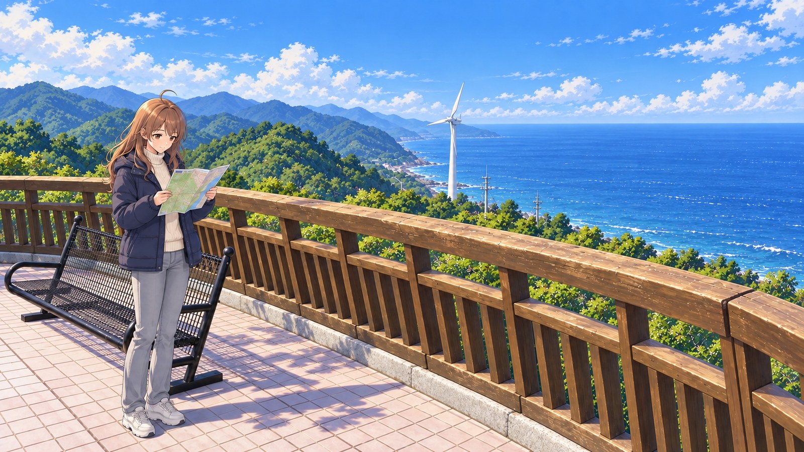
I took a midday detour to look out to sea in my navy winter coat and turtleneck. Once I opened the map, I started eyeing the roads I wanted to take next.
WinterMidday in early February
I opened my map and compared it with the coastline before me
At midday in early February, I drove up Muroto Skyline to the summit observatory. I parked and stepped onto the deck, where the Pacific stretched out to my right. A series of green mountain ridges rose to my left, with the coastline stretching on beyond them. I drew my navy coat closed and stood by the wooden handrail. From here, the shape of the land seemed clearer than it had while I was driving along the coast.
I unfolded the map with both hands and looked for the road I’d just driven. It was only a short line on paper, but in the car, the scenery had changed again and again. When I looked up from the map, another mountain rose beyond the coast. I wonder if the roads ahead link up like that, too. Things I hadn’t thought about while driving started to catch my attention when I stopped here.
The black bench beside me and the wooden handrail both face the sea. I held down the edge of the map and looked out toward the water in the distance. It felt just right to have time for both: reading the map in my hands and simply looking out at the sea. I’d unfolded the map to plan what came next, but my attention kept drifting toward the view.
Near the coast, I could also see a white wind turbine. Apparently, Shikoku’s first wind power facility is nearby. As I looked out over the forest and sea, the turbine’s white shape made me think about the everyday life going on here, too. I traced the coastline again from the direction of the wind turbine, and it became easier to picture where that stretch was on the map.
I found Muroto on the map and started thinking about lunch. Muroto Kinme-don is a local specialty: a rice bowl topped with teriyaki-glazed splendid alfonsino and sashimi made with local fish. If I can try both, that sounds just right after today’s seaside stop. The thought of lunch after my visit finally got me to fold up the map.
Before I got back in the car, I took one more look out over the coast. It had started to feel as though I’d come here to choose which road to take next, but simply looking out at the sea had become part of today’s trip, too. I folded the map along its creases and tucked it inside my coat. Remembering the shape of the land from the summit made me look forward to driving back along the coast.
The story sections are fiction inspired by this location. For accurate information, please consult official tourism and information websites.
Local specialty
Muroto Kinme-don
A rice bowl topped with teriyaki-glazed splendid alfonsino caught off the coast of Muroto and sashimi made from local fish. Each restaurant has its own splendid alfonsino broth to go with it. I’d love to have it for lunch after coming down from the observatory. After taking in the sea, look for a restaurant in town to enjoy.
Highlights
The Pacific and the shape of the cape from the summit
The observatory was built at the highest point on Muroto Skyline. From here, you can see the Pacific and get a sense of how Muroto juts out into it. Bring a map, and you’ll start wondering where the road goes next.
A wind turbine along the coast
Shikoku’s first wind power facility is nearby. From the wooden handrail, I watched the white turbine, then followed the coastline with my eyes. Its white silhouette caught my eye between the green mountains and the sea.
Estimated drive times to Muroto
Drive to Muroto Skyline Summit Observatory
- From Nankoku IC
- About 1 hour 50 minutes
- From Geisei-Nishi IC
- About 1 hour 20 minutes
Kochi Prefecture’s tourism site lists estimated driving times from two different interchanges. Add a stop at the summit observatory to your drive along Muroto’s coast.
The two times are for drives from separate interchanges to the observatory. Use the map to trace the route and plan how to combine the coast with a stop at the summit.
More Spot Guides
If you enjoyed this story, you might like these places too. I've gone back to each of them in different seasons, again and again.